● Old maps · oldmaps.geolab.cz
Old maps
Presentation of old maps covering the area of Czechia, Moravia and Silesia
01
About
Among other things of interest, the Geoinformatics Laboratory of the J. E. Purkyně University in Ústí nad Labem is engaged in using old maps and their potential for landscape studies. One of the first steps was a research project assigned by the Ministry of the Environment – its primary goal was to obtain copies of the 1st and 2nd Military Survey from the Austrian State Archive / War Archive in Vienna, where the originals are kept, and to present them in digital form on these pages.
After an agreement with the Historical Institute of the Czech Academy of Sciences, we created an online presentation of Müller's maps of Bohemia and Moravia.
Together with the National Heritage Institute we digitised part of the Stable Cadastre: about 1,200 map sheets of 205 cadastral areas in Bohemia and Moravia.
The latest addition is an incomplete set of the 3rd Military Survey, provided in digital form by the Nature Conservation Agency of the Czech Republic.
02
1st Military Survey
Josephine · 1764–1768 and 1780–1783 (rectification) · 1 : 28 800
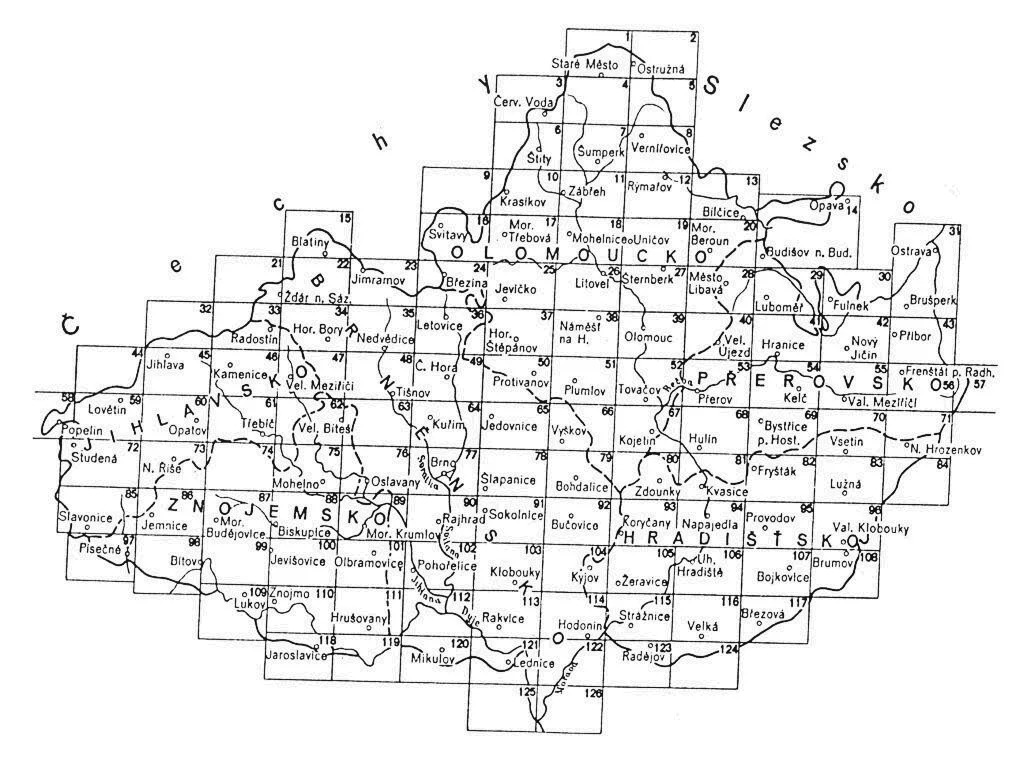
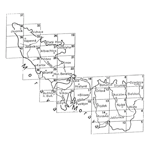
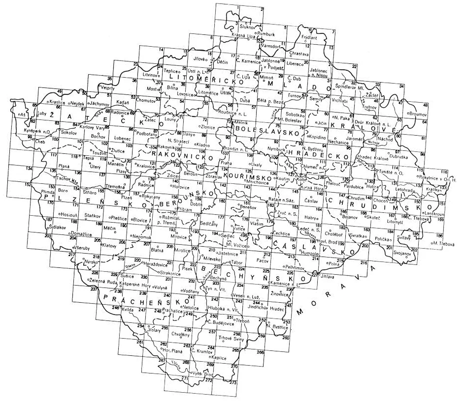
As the base of this survey Müller's maps, transformed to the larger scale of 1 : 28 800, were used. Officers of the Military Topographic Service rode through the country on horseback and mapped it using the “à la vue” method, which means that they simply observed the terrain and estimated the distances. An officer was able to map up to 350 km² per summer. The survey was not based on any net of precisely defined trigonometric points because of the financial and time limits of the work. This is why it was not possible to compile a map of the whole Austrian Monarchy from the individual sheets.
Great attention was paid to communications (classified by trafficability – e.g. the so-called imperial roads), rivers, streams and artificial ditches, land use (arable fields, meadows, pastures etc.) and various types of buildings – churches, mills etc. Thanks to the different colours of the individual landscape components (the maps were coloured by hand) they are easy to distinguish.
Together with the maps, military-topographical descriptions of the area were recorded, containing information that is not in the maps, such as the width and depth of rivers, the state of roads and trails, supplies of the settlements etc. The material for Bohemia alone consists of 19 manuscript volumes.
At the edge of each sheet there is a list of settlements with columns for the number of inhabitants, horses etc. On some sheets these columns are blank, but the information can be found in the military-topographical descriptions mentioned above.
The importance of the 1st Military Survey lies not only in its detail, scale and almost exhaustive written descriptions, but also in the period of its origin. It shows Bohemia, Moravia and Silesia just before the beginning of the industrial revolution, in the period of the full bloom of the cultural baroque landscape and its highest diversity.
03
2nd Military Survey
Franciscan · 1836–1852 · 1 : 28 800
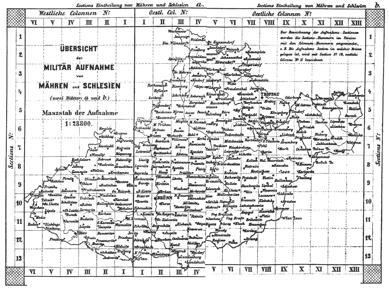
Unlike the 1st Military Survey, the 2nd one was based on a trigonometric network and on the cadastral maps of the Stable Cadastre at 1 : 2 880, so its precision is much higher. Besides the maps at 1 : 28 800, the so-called general (1 : 288 000) and special (1 : 144 000) maps were derived from it.
The contents of the sheets are in fact identical with the previous survey, with the addition of the altitudes of trigonometric points (in Viennese fathoms), but the recorded situation is very different. The 2nd Military Survey was carried out when the industrial revolution was under way and intensive farming was spreading: the area of arable land had grown by about 50 % in 100 years and the forests in our country reached the smallest extent in their history.
04
3rd Military Survey
Francis Joseph · 1876–1878 (Moravia and Silesia), 1877–1880 (Bohemia) · 1 : 25 000
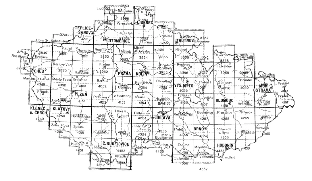
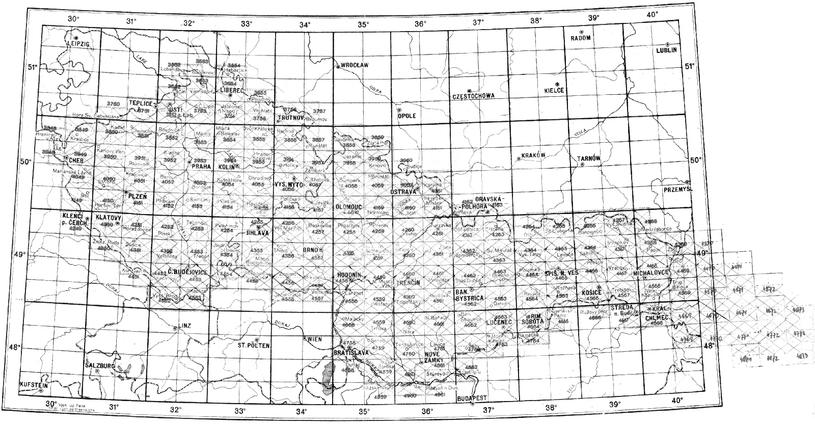
This text is only available in Czech.
Jelikož Františkovo mapování již nestačilo požadavkům armády rakouské monarchie na přesné a hlavně aktuální mapy, r. 1868 rakouské ministerstvo války rozhodlo o mapování novém. Jeho podkladem se opět staly katastrální mapy, oproti II. vojenskému mapování je vylepšeno znázornění výškopisu – nejen šrafami, ale také vrstevnicemi a kótami. Výsledkem mapování jsou kolorované tzv. topografické sekce, z nichž přetiskem vznikly mapy speciální (1 : 75 000) a generální (1 : 200 000), které již byly tištěny černobíle.
Po vzniku samostatného Československa byly mapy předány z Vídně Vojenskému zeměpisnému ústavu v Praze. Zatímco speciální mapy byly reambulovány a hojně používány nejen v armádě až do roku 1956, původní kolorované sekce zmizely ze zorného pole kartografické veřejnosti. Po mnoha letech se podařilo část mapování dohledat a v prostředí aplikace Zoomify vizualizovat. Mapové listy v počtu 234 se neočekávaně objevily v Mapové sbírce UK Praha a jejich digitalizaci provedla Agentura ochrany přírody a krajiny – pracoviště Brno.
Z přehledu existujících mapových listů je patrné, že nemalá část chybí. Pokud někdo z uživatelů ví o existenci chybějících mapových listů a byl by ochoten list(y) zapůjčit k naskenování, laboratoř a nejen ona to velmi uvítá a doplní do aplikace.
05
Müller's maps
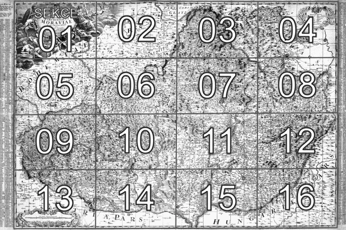
Müller's map of Bohemia (1720) and Müller's map of Moravia (1716) in the 1790 edition
This text is only available in Czech.
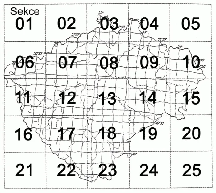
Mappa geographica regni Bohemiae in duodecim circulos divisae cum comitatu Glacensi et districtu Egerano adjunctis… a Joh. Christoph. Müller… A. C. MDCCXX. Michael Kauffer sculpsit Augusta Vind. Mědirytina, 1720, grafické měřítko [cca 1 : 132 000], 25 sekcí, rozměr sekce 465 × 540 mm, celkem 2403 × 2822 cm. Mapový obsah ryl Michael Kauffer, parerga Johann Daniel Herz podle návrhu Václava Vavřince Reinera. Mapová sbírka Historického ústavu Akademie věd České republiky, sign. VII/4/A-2587.
Mapa Čech Jana Kryštofa Müllera z roku 1720 patří k nejkrásnějším a nejcennějším kartografickým dílům naší minulosti. Svými rozměry, obsahem, kartografickým i výtvarným zpracováním předčí mnohé jiné mapy, domácí i zahraniční. Vznikla na základě vojenských, správních a hospodářských požadavků státu (rakouské monarchie). Proto jsou na ní podrobně zakresleny kromě topografického obsahu (sídla, vodstvo, schematicky reliéf a zeleň, komunikace) také zemědělské usedlosti, zaniklé osady, mlýny, vinice, doly na zlato, stříbro, měď a další nerostné suroviny, hutě, sklárny, poštovní stanice a mnoho jiných informací, vysvětlených v bohaté legendě mapy.
Tabula generalis marchionatus Moraviae in sex circulos divisae… Ioh. Christoph Müller S. C. M. capitaneus. Mědirytina, 1716, grafické měřítko [cca 1 : 180 000], 974 × 1374 mm. Mapový obsah ryl brněnský rytec Jan Kryštof Leidig. 2. vydání Franz Reiser, Brno, kolorovaná mědirytina, 4 listy o rozměrech celkem 1020 × 1400 mm bez rejstříků zeměpisných jmen, 1020 × 1880 mm s rejstříky. Soukromá sbírka.
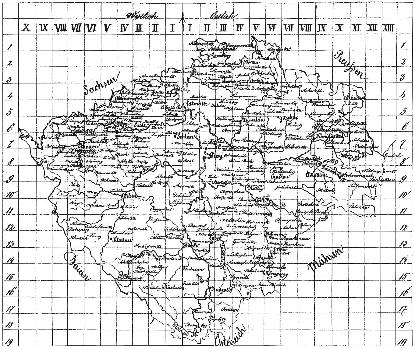
Müllerova mapa Moravy z roku 1790 se od vydání 1716 liší jen nepatrně. Ve 2. vydání byla rytina mapy místy doplněna šrafovým znázorněním reliéfu a celá mapa je pokryta čtvercovou sítí, označenou vodorovně písmeny A–Z a svisle A–Q, která umožňuje vyhledávání zeměpisných jmen v rejstřících na okraji mapy. Z důvodů uživatelských je digitalizovaná mapa rozdělena na 16 pracovních sekcí.
Laboratoř geoinformatiky UJEP po dohodě s dr. Evou Semotanovou zpřístupňuje široké veřejnosti citované mapové dílo. Text: Dr. Eva Semotanová, Historický ústav AV ČR. Digitalizace map Pavel Vychodil.
06
Stable Cadastre
This text is only available in Czech.
Mapy Stabilního katastru byly digitalizovány v rámci projektu laboratoře Staré mapy v prostředí internetu ve spolupráci s Národním památkovým ústavem. Preferovány byly tzv. povinné císařské otisky, což jsou nejlépe zachované kopie originálních map vytvářených přímo v terénu. Povinné císařské otisky vynikají jemnými a jasnými barvami a neobsahují žádné dodatečné vpisy. V případě katastrálních území, pro něž se povinné císařské otisky nezachovaly, byly naskenovány originální mapy.
Z velkého množství dochovaných verzí map stabilního katastru jsou pro účely sledování vývoje krajiny nejvhodnější povinné císařské otisky v měřítku 1 : 2 880, při podrobnějších měřeních (centra měst) také 1 : 1 440 a 1 : 720, které zachycují stav v době mapování, tj. 1826–1843 (Čechy) a 1824–1836 (Morava a Slezsko).
07
Citation
If you use one or more sections of the military surveys, or part of a section, in a publication, please add the following citation:
- © 1st (2nd) Military Survey, Section No. xy, Austrian State Archive/Military Archive, Vienna
- © Laboratoř geoinformatiky Univerzita J. E. Purkyně – http://www.geolab.cz
- © Ministerstvo životního prostředí ČR – http://www.env.cz
For Müller's maps please cite:
- © Historický ústav AV ČR – http://www.hiu.cas.cz
- © Laboratoř geoinformatiky Fakulty životního prostředí Univerzity J. E. Purkyně
08
Links
- David Rumsey Map Collection
- Library of Congress – Map Collections
- Historical Mapping (old-maps.co.uk)
- Mollova mapová sbírka – MZK Brno
- Old Maps Online
- Staré mapy – staremapy.cz
- Mapová sbírka Historického ústavu AV ČR
Projects
- GA ČR 205/04/0888 – Georeferencování a kartografická analýza historických mapování Čech, Moravy a Slezska ↗
- GA ČR 205/07/0385 – Kartometrická a semiotická analýza a vizualizace starých map českých zemí z období 1518–1720 ↗
© Geoinformatics Laboratory, J. E. Purkyně University, 2001–2017 · web application by Jan Dušek · OpenLayers viewer by the Moravian Library in Brno